Photo courtesy of Jasper Yellowhead Museum and Archives PA84.32.37
The Evolution of the Wonder Trail
Once deemed one of the world’s top 10 most scenic roads by National Geographic, the Icefields Parkway is a 230-kilometre stretch of highway that connects the mountain towns of Lake Louise and Jasper.
And it might not have existed at all, had a scientist been a little more careful with his measurements.
A simple mistake
In 1827, David Douglas, a botanist for the Hudson Bay Company, was struck by the impressive size of two mountains on either side of the Athabasca Pass in the Canadian Rockies. He incorrectly recorded their elevations as the highest points in Western Canada, kicking off more than 60 years of unsuccessful expeditions by mountaineers trying to find and conquer them.
Geologist Arthur Coleman was one of these intrepid explorers, searching for one of the elusive peaks in 1884. Although he never found what he was looking for, his journey was not fruitless—the route he took from Sunwapta River to Jasper would ultimately become the Icefields Parkway.
The Wonder Trail
The natural beauty of the trail Coleman found led Arthur Oliver Wheeler, the principal land surveyor plotting the border between Alberta and British Columbia, to offer an accurate prediction: “Through dense primeval forests, muskeg, burnt and fallen timber and along rough and steeply sloping hillsides, a constant flow of travel will demand a broad, well-ballasted motor road,” he wrote in a 1920 journal entry. “This wonder trail will be world renowned.”
Early explorers to the area began guiding tourists along the trail, a three-week endeavour that included stops at several base camps. As the area grew in popularity, there was a push to increase the Wonder Trail’s accessibility.
Creating jobs—and making history
That opportunity came in 1931 as part of a Depression-relief program. Western Canada’s unemployment rate was around 30 per cent, and the Government of Canada saw an opportunity to create jobs connecting the boundaries of Jasper and Banff national parks. The Wonder Trail was slated to become a single-track road.
This ambition employed more than 600 men over nearly 10 years. To stretch the length of employment, the government had the road built with pickaxes and shovels, with each crew allowed only one tractor. Surveyors created the route on the fly—they avoided dips and hills considered too much trouble to fill or remove, leading to the route’s famous bends and turns.
The workers were paid $5 a month—the equivalent of $84 today—and received a stipend for tobacco and clothing. Foremen received $60 a month—$1,000 today.
By 1940, Alberta had created the first road in the world that could bring motorists to the toe of a glacier.
More than 600 men built the Icefields Parkway—connecting the mountain towns of Lake Louise and Jasper—using pickaxes, shovels, and one tractor per crew. The work, part of a Depression-relief program, took nearly 10 years to complete.
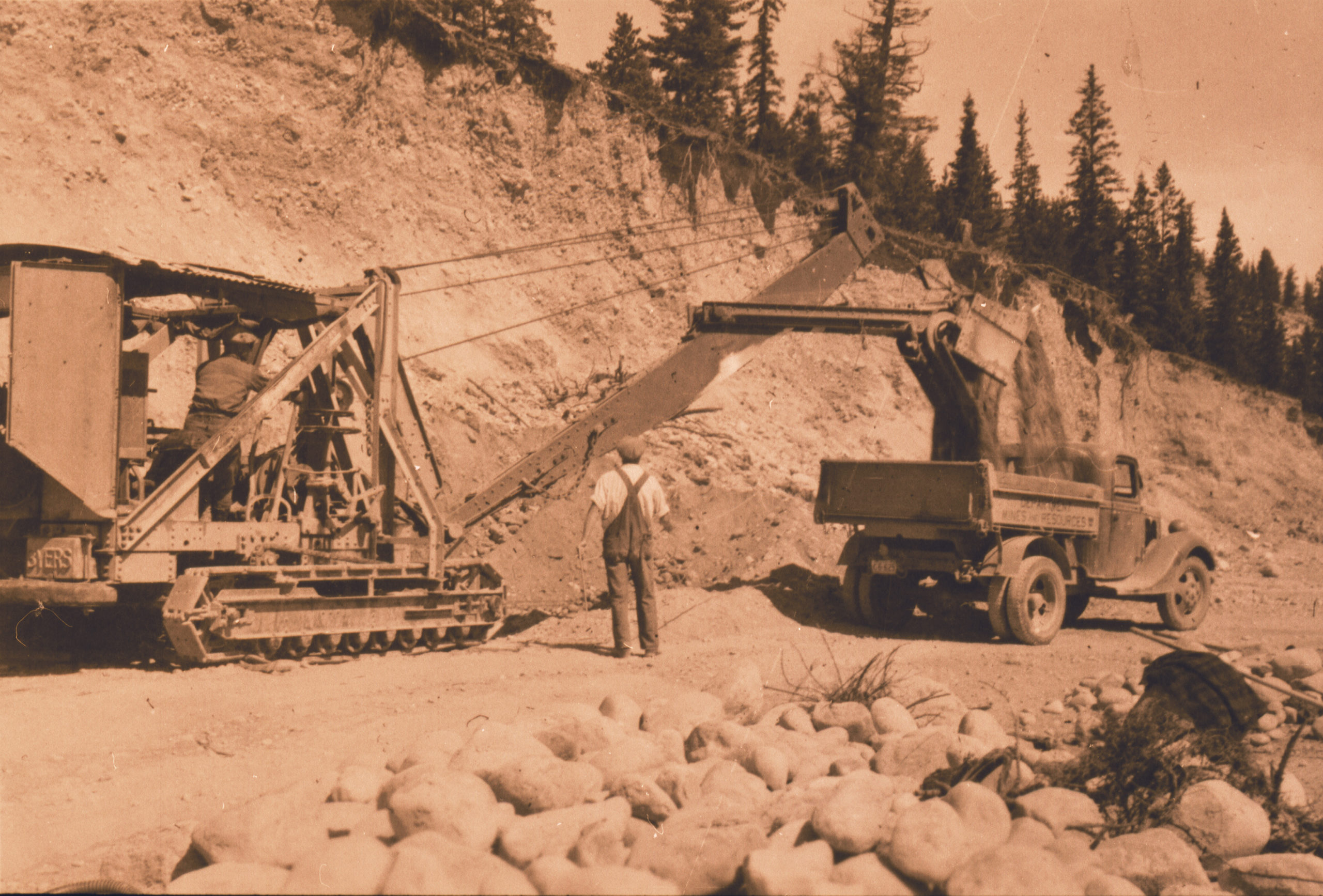
Photo courtesy of Jasper Yellowhead Museum and Archives PA000.50.12
The drive of a lifetime
With the completion of the Icefields Parkway, the journey that had once taken three weeks on horseback could be managed in seven or eight hours. In 1962, the natural beauty of the area caught Hollywood’s attention, and the road was paved and realigned to accommodate the influx of visitors.
Today, you can finish the drive in three to five hours by car.
But you might not want to.
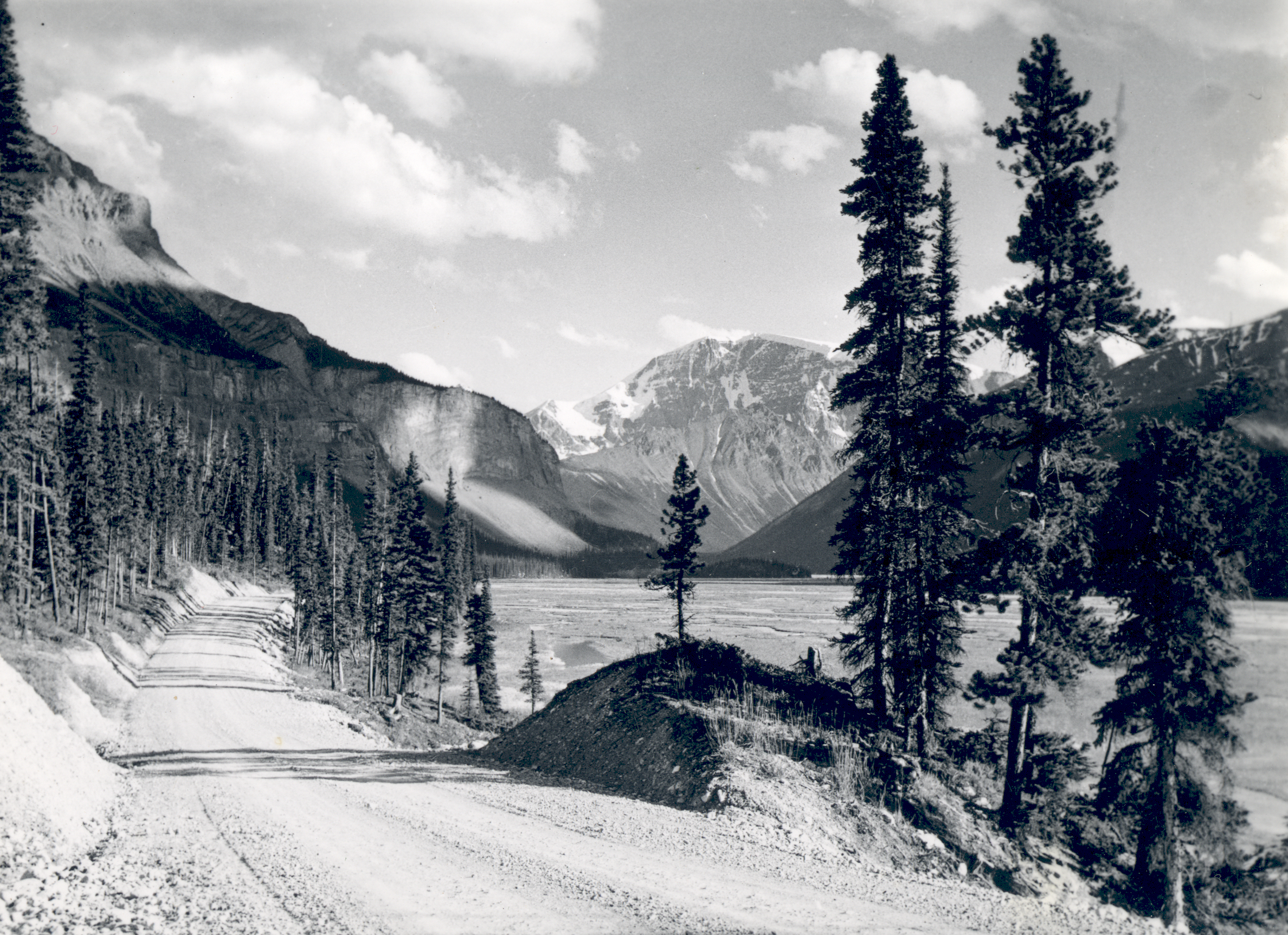
The view as you head south through the Canadian Rockies to Lake Louise. The Icefields Parkway is a beautiful tour through the mountains.
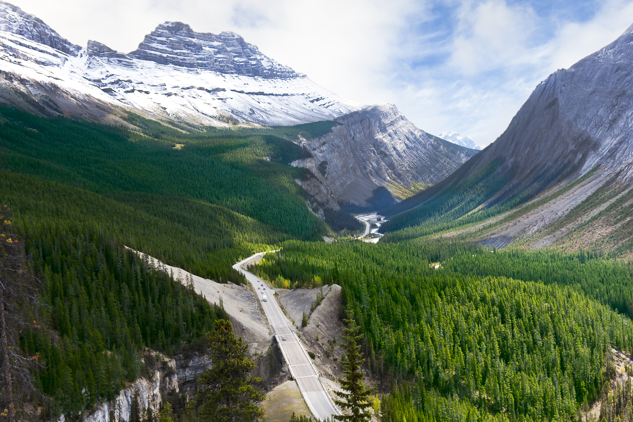
Photo courtesy of istock/handsomepictures