Provincial Archives P2140
Life in the Field: Geologists Explore Nordegg Wilderness
They trekked across mountains. Dug up fossils in the badlands. Battled bugs in the bush. Early geoscientists were intrepid explorers, equally at home in an office, a lab—or the wilderness.
In the fall of 1952, a group of geologists trekked into the mountains near Nordegg. Their photos capture glimpses of life at field camp and the work they did for Royalite Oil Co.
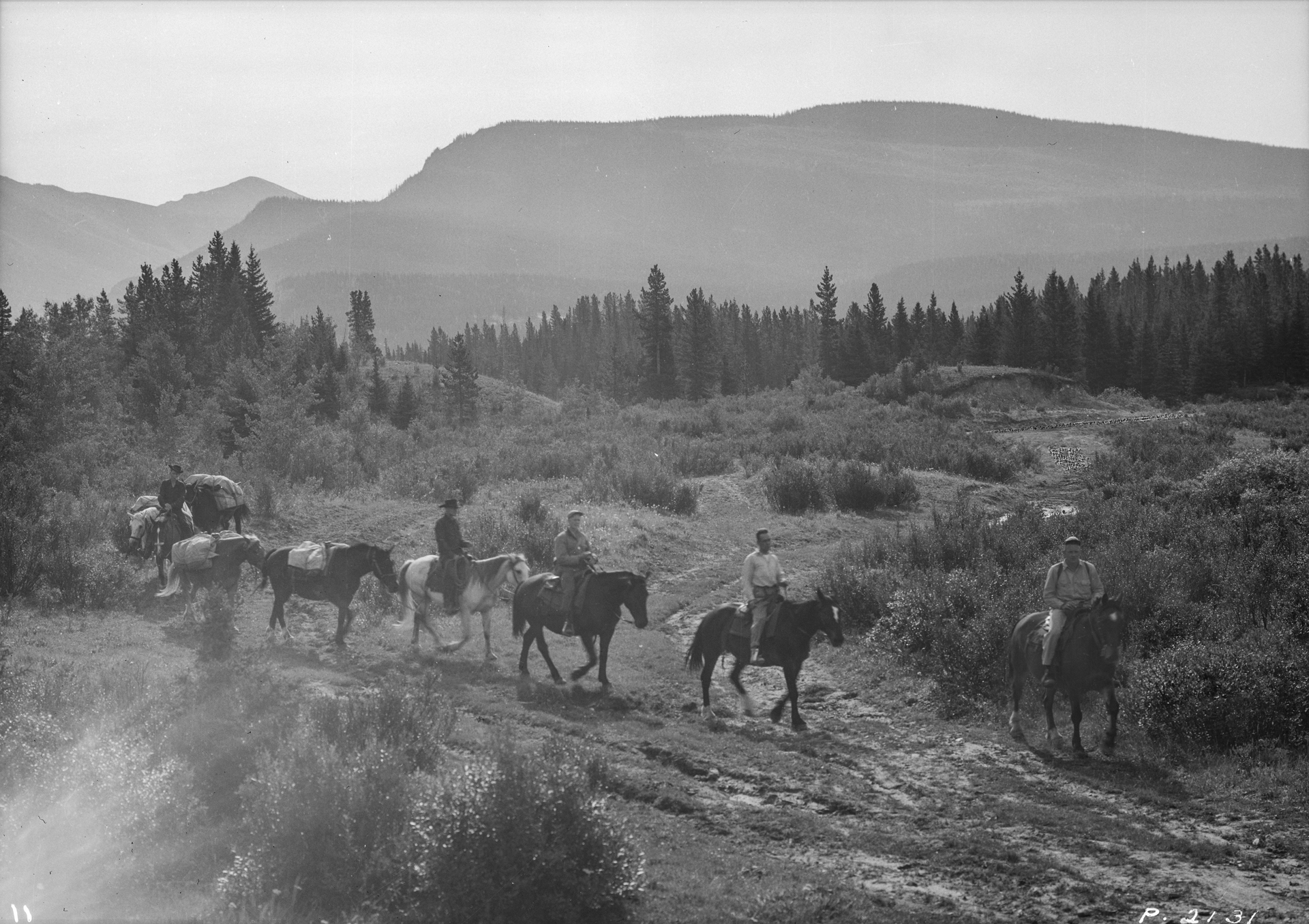
In the first half of the 20th century, horses were a main mode of transportation for geologists heading into the wilderness. Geological parties often explored the backcountry for weeks and even months, and they had to pack in enough supplies to last the whole trip. Helicopters eventually replaced horses—and even dog sleds—providing geologists with easier access to remote locations.
Provincial Archives P2131
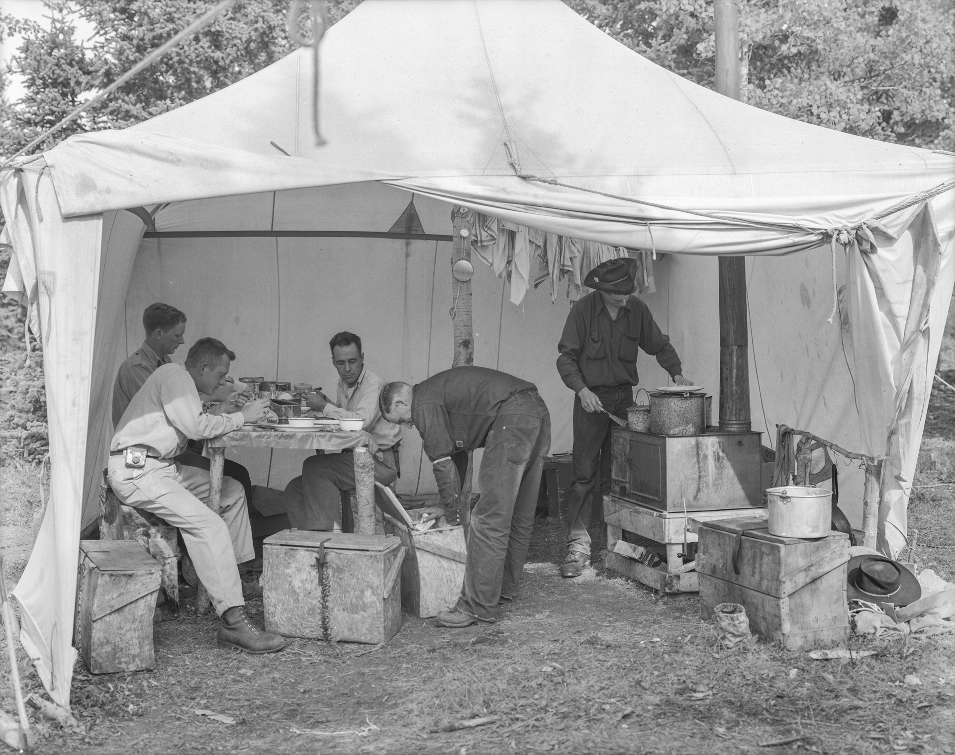
A typical field camp cookhouse. Note the handmade log table, the collapsible iron stove, and the porcelain cookware. We can’t know for sure, but the party was likely enjoying typical fare: soda crackers and soup.
Provincial Archives P2134
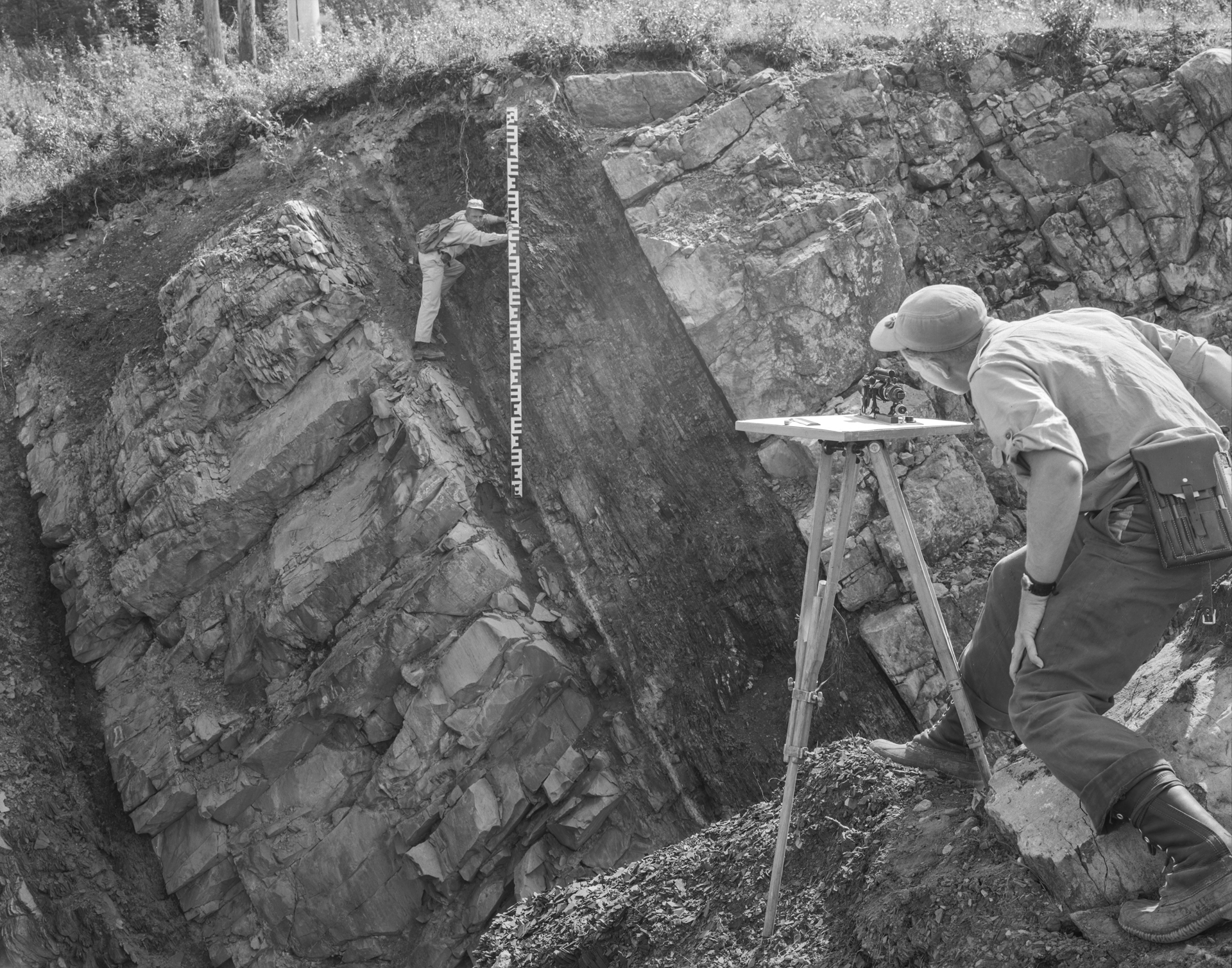
A plane table and a telescopic alidade (at right) are tools for mapping the topography of a thrust fault, probably in the vicinity of Ram Falls Provincial Park. The giant ruler—called a stadia rod—was used as a target for measuring distances and elevations in conjunction with the plane table. At each set up, plane tabling required a surveyor’s compass to determine true north and a plumb bob to ensure the table was level. Modern geoscientists still go on field trips, but plane tabling has been out of the picture for about 40 years. To map geological outcrops, today’s geoscientists use GPS-equipped computers, software, and apps.
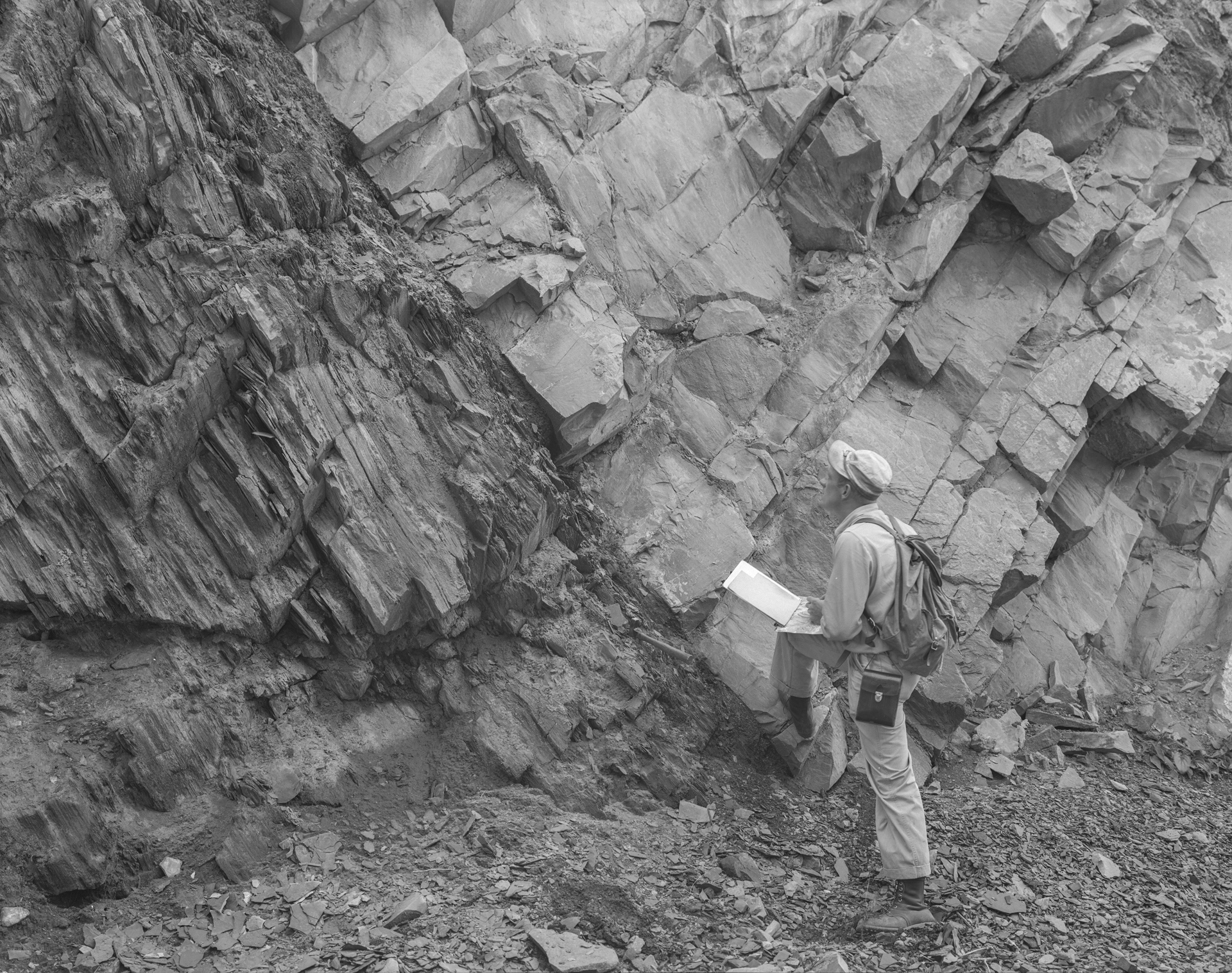
Provincial Archives P2140
Taking an up-close look at a thinly bedded shale fault.
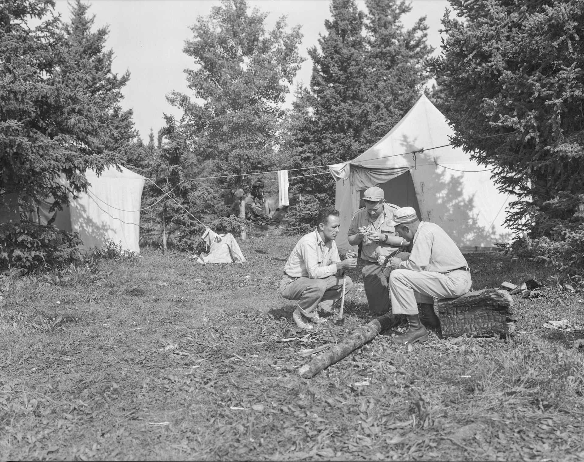
Provincial Archives P2141
Back at field camp, the geologists use a hand lens and rock hammers to examine limestone samples. Analyzing the structure of the rocks and how porous they are would have helped them determine the likelihood of oil.
Provincial Archives P2137
Imperial Oil Search Unending – as seen on the Glenbow Museum's YouTube channel. Video includes footage of geologists in Alberta’s Rocky Mountains exploring for oil.

